
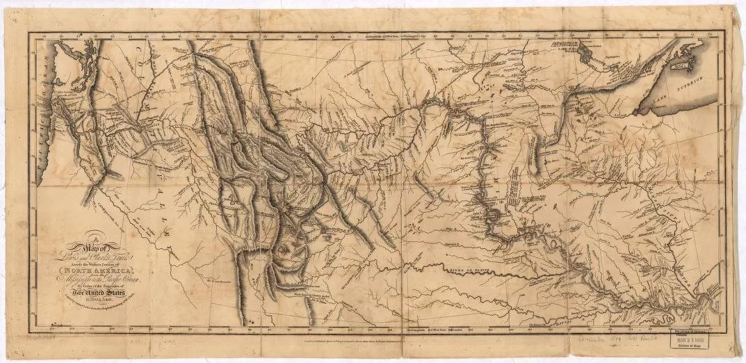
19th-century map traces the full route of the Lewis and Clark Expedition as it pushed west from the Mississippi River to the Pacific Ocean between 1804 and 1806. Drawn from the explorers’ own observations, it shows the Missouri River’s winding path, the rugged Rocky Mountains, and the network of tribal lands and waterways they encountered along the way.
29115 Route 2 N.
Hillsdale, Illinois
Phone Number
The Preeminent Source for Antique Flags.
Your Custom Text Here