
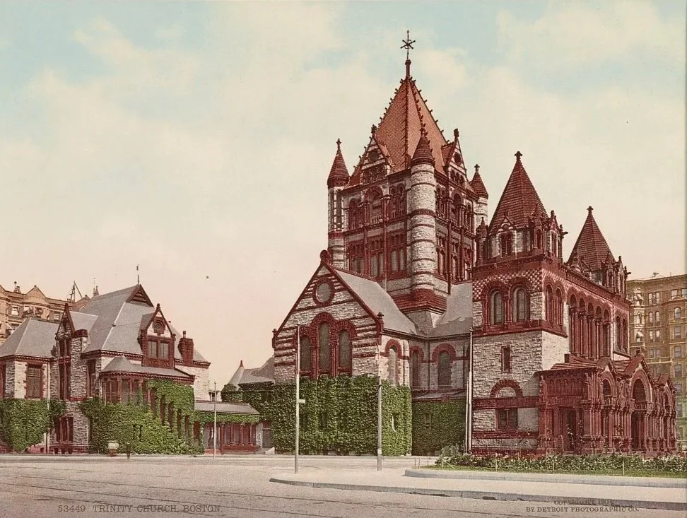
Trinity Church in Boston, seen here around 1900, was already a city landmark by the turn of the century. Completed in 1877 and designed by architect Henry Hobson Richardson, the church broke from traditional European church designs and helped shape what became known as the Romanesque Revival in America. Its massive stonework, broad arches, and prominent tower reflected the confidence of a growing Boston after the Back Bay was filled in.
Parade of Civil War veterans and children carrying American and Alaska flags
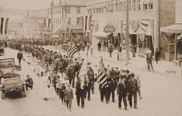
A patriotic parade moving down a busy main street, with marchers carrying American flags past stores and restaurants. Signs for a U.S. Navy Yard and a Great Northern Railway office highlight how military activity and rail transportation shaped local life and commerce. Spectators line the sidewalks while cars and bicycles share the road, capturing a moment when older traditions and modern life overlapped.
Votes for women : suffrage rallying song
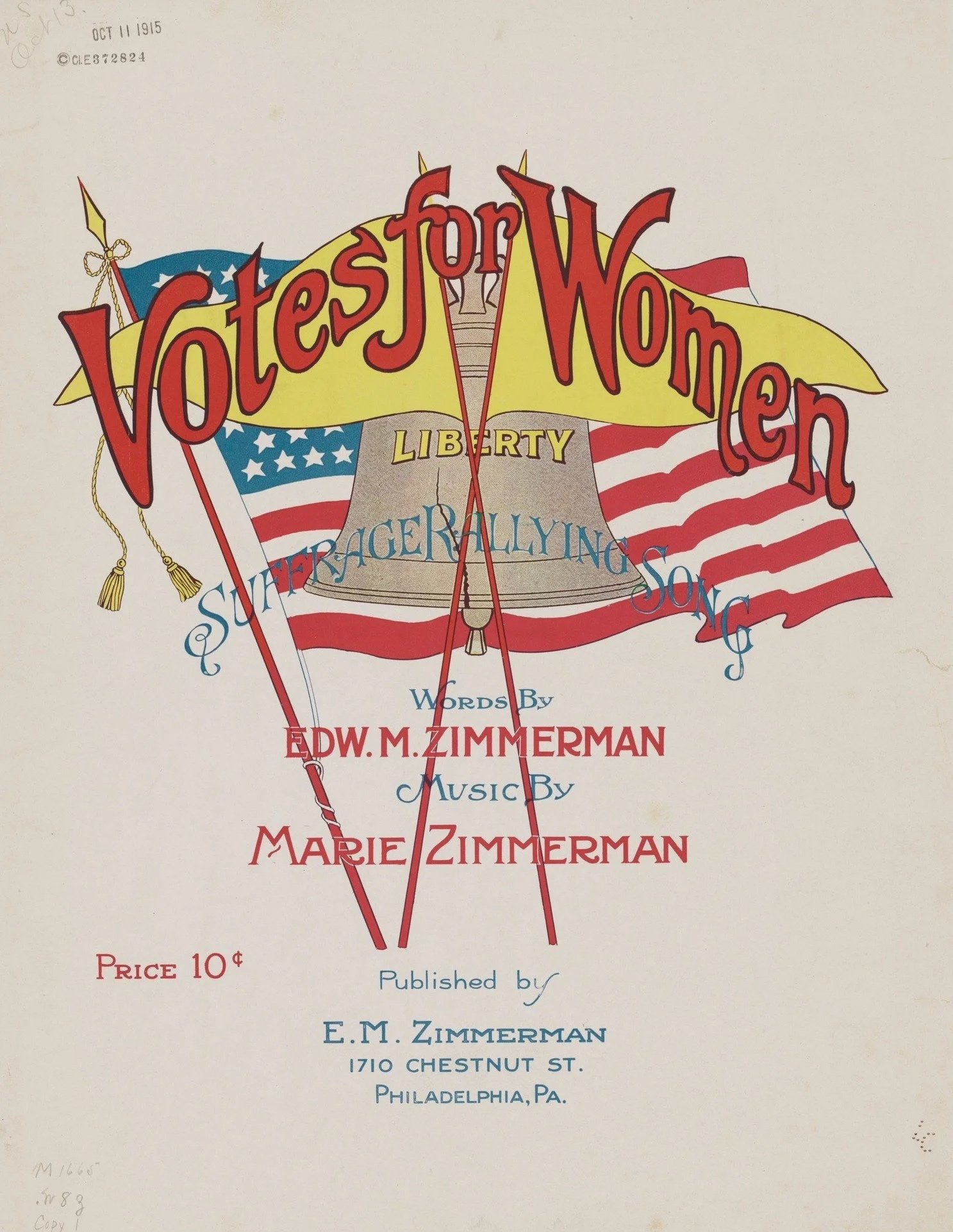
During the early women's suffrage movement, rallying songs like Votes for Women were sung at marches and meetings to build unity and keep the message simple and memorable. Printed sheet music helped spread these songs far beyond major cities, allowing supporters across the country to take part. Items like this show how the fight for voting rights was carried not just through speeches and demonstrations, but through everyday culture and shared voices.
Together we win / James Montgomery Flag
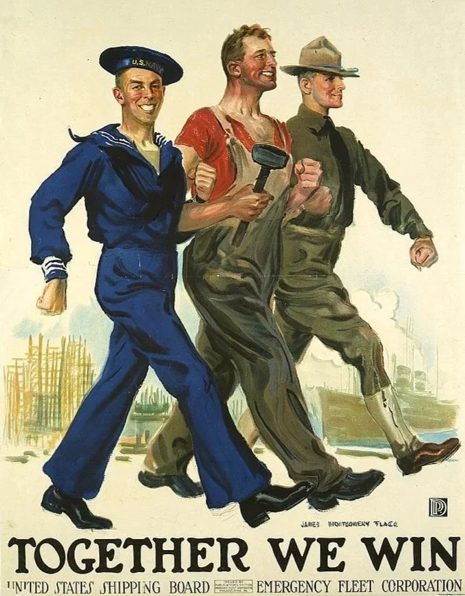
World War I–era poster shows a shipyard worker marching in step with a sailor and a soldier, driving home the message that the war effort depended on everyone. Created for the United States Shipping Board’s Emergency Fleet Corporation, also showing that industrial labor supported troops overseas by building and supplying ships. The hammer and dockside setting connect factory work directly to national defense. Helping Americans see shipyards and workshops as front-line contributions, not just support roles.
High bridge near Buena Vista
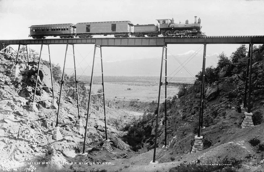
Steam locomotive crossing a tall trestle bridge near Buena Vista, a reminder of how railroads pushed through difficult terrain as the country expanded. The narrow bridge and steep drop below show the kind of engineering required to carry rail lines across canyons and ravines. Structures like this made it possible to move people, supplies, and resources into remote areas, supporting settlement and local industry. Scenes like this capture how railroads physically reshaped the landscape and helped link growing communities across the West.
Map of Lewis and Clark's Track Across the Western Portion of North America
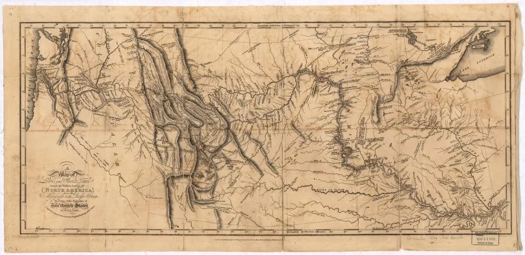
19th-century map traces the full route of the Lewis and Clark Expedition as it pushed west from the Mississippi River to the Pacific Ocean between 1804 and 1806. Drawn from the explorers’ own observations, it shows the Missouri River’s winding path, the rugged Rocky Mountains, and the network of tribal lands and waterways they encountered along the way.