
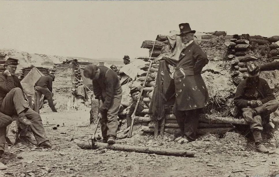
In December 1862, soldiers of the 110th Pennsylvania Infantry camped near Falmouth, Virginia, just across the Rappahannock River from Fredericksburg during a critical phase of the Civil War. Men gather around rough log shelters and tents, tending to everyday tasks and equipment while waiting for orders. Conditions in camps like this were often harsh, with cold weather, limited supplies, and constant uncertainty.
Three Unidentified Soldiers in Union Uniforms
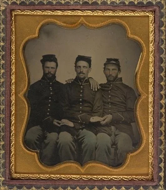
Three Union soldiers sit closely together in their uniforms during the Civil War, their caps and buttoned coats marking them as members of the Federal army between 1861 and 1865. Their steady expressions and informal pose suggest a moment taken away from the demands of camp or campaign, when soldiers often visited photographers to create keepsakes for family and friends. Images like this served as personal records in a time of uncertainty, when many who enlisted did not return home.
Troops of the 32nd Regiment, Indiana Volunteers
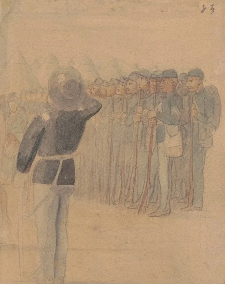
Union soldiers of the 32nd Indiana Infantry stand in formation during the Civil War, their rifles held at rest as they face an officer giving commands. Created between 1861 and 1865, the drawing reflects the discipline and structure that defined volunteer regiments drawn from communities across the North. Many of these men were recent immigrants or first-generation Americans, serving in units that often shared language and cultural ties. Their orderly ranks and simple equipment illustrate the realities of citizen-soldiers preparing for prolonged conflict, as the Union relied on such regiments to sustain its military campaigns and preserve the nation.
Drummer Jesse W. Mills of Co. G, 51st New York Infantry Regiment in Zouave Uniform with Drum
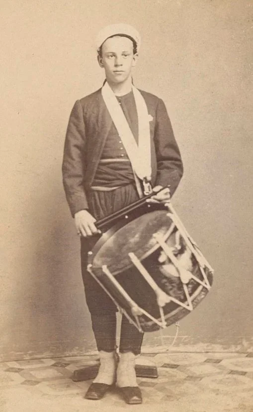
A young drummer of the 51st New York Infantry stands in full uniform during the Civil War, his drum suspended by a shoulder strap and held ready at his side. Musicians like him played a critical role in Union armies, using drumbeats to relay orders across the chaos of battle and to regulate the daily routines of camp life. The distinctive zouave-style uniform reflects a popular mid-19th century military fashion inspired by French units, adopted by several American regiments for its striking appearance.
G.A.R. PARADE GREAT FLAG AT CAPITOL
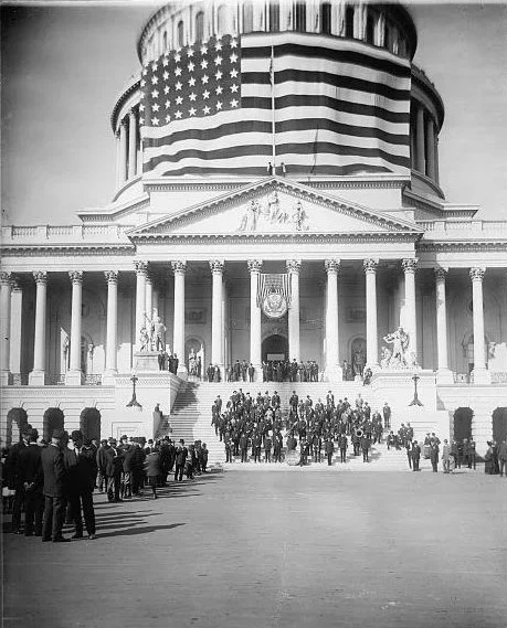
Veterans of the Grand Army of the Republic gather at the U.S. Capitol beneath a massive American flag during a commemorative parade in the early 20th century. Formed by Union veterans of the Civil War, the organization played a major role in shaping public memory of the conflict and advocating for soldiers’ benefits.
Flag of 37th Pennsylvania Infantry
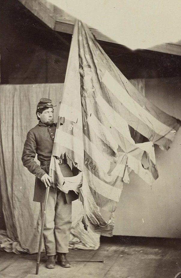
A Union soldier stands with the battle-worn flag of the 37th Pennsylvania Infantry, its torn fabric bearing the marks of heavy service during the Civil War. Regimental colors served as both a rallying point in combat and a symbol of unit identity, often carried into the most dangerous positions on the field. The damaged banner reflects the intensity of the fighting and the sacrifices made by volunteer soldiers, while preserving the legacy of a unit that endured some of the war’s hardest campaigns.
Sherman's March Through South Carolina - Burning of McPhersonville, February 1, 1865
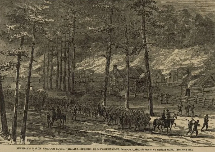
William Tecumseh Sherman’s campaign through South Carolina in February 1865 is captured in this depiction of Union troops moving through McPhersonville as buildings burn in the background. The march formed part of a broader strategy to break the Confederacy’s capacity to wage war by targeting infrastructure and supply lines. Columns of soldiers and mounted officers advance steadily while smoke rises over the town, illustrating the hard war tactics that hastened the Confederacy’s collapse in the final months of the Civil War.
Parade of Civil War Veterans and Children Carrying American and Alaska Flags on Urban Downtown Street
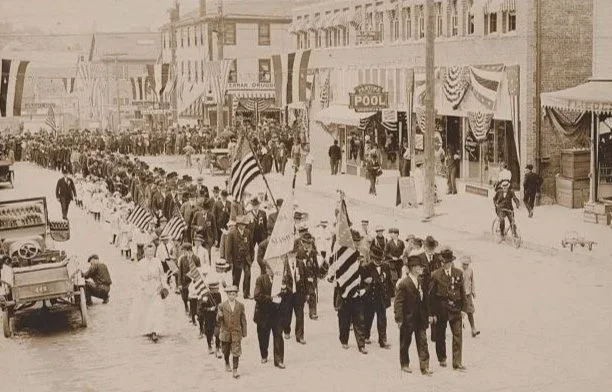
A parade of Civil War veterans marches through a busy downtown street in the early 20th century, accompanied by children carrying American and Alaska flags. Organized at a time when surviving veterans were aging, such public displays honored their service and reinforced national unity decades after the war. The presence of younger generations alongside the veterans reflects an effort to pass down memory and patriotism, while the decorated storefronts and gathered crowds show how communities marked these occasions as civic events tied to identity and remembrance.
Celebration at Bull Run, July 21, 1911
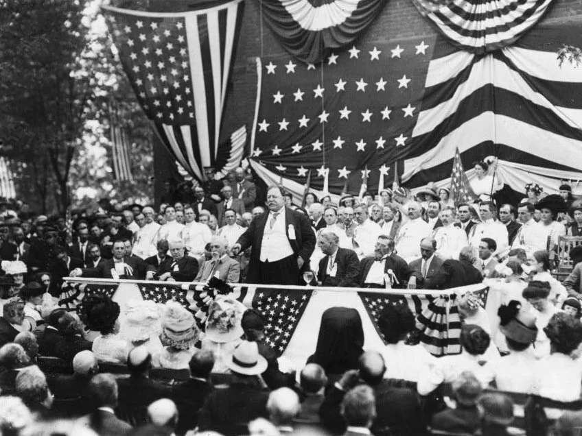
William Howard Taft speaks before a large crowd at Bull Run in 1911 during events marking the 50th anniversary of the first major battle of the American Civil War. Veterans, officials, and spectators gathered at the historic battlefield to remember the conflict and its lasting impact.
General French, Taken in Camp on the Chickahominy, 29th of May, 1862
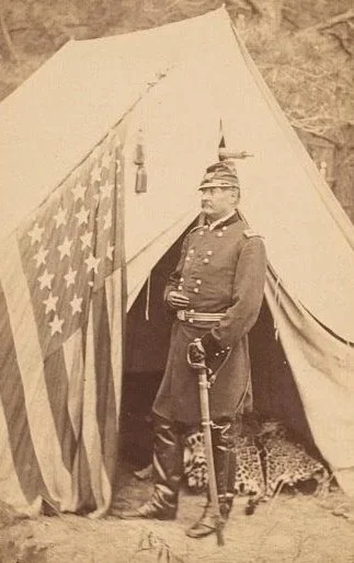
William Henry French, an officer in the U.S. Army’s 2nd Mounted Artillery, stands outside his field tent along the Chickahominy River in May 1862 during the American Civil War. A U.S. flag hangs at the entrance while the general appears in full uniform with sword at his side. Images like this were often produced by studios connected to Mathew B. Brady, whose photographers documented Union officers and soldiers during the war, creating some of the most enduring visual records of the conflict.
Charleston, South Carolina. Flag-Raising Ceremony at Fort Sumter. Awaiting the Arrival of Gen. Anderson and Invited Guests to Inaugurate the Ceremony of Raising the Flag
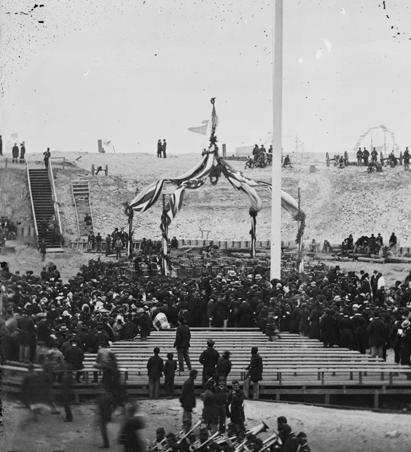
Crowds filled the interior of Fort Sumter in Charleston Harbor on April 14, 1865, waiting for the flag to be raised again over the fort where the Civil War had begun. A simple platform trimmed with bunting stood at the center, surrounded by soldiers, officials, and civilians who had come to witness the moment. Major General Robert Anderson, who surrendered the post in 1861, returned to lift the same flag that had been lowered at the start of the conflict. Four years of war had passed, and the ceremony served as a public sign that the Union had been restored.
Lincoln's Second Inaugural
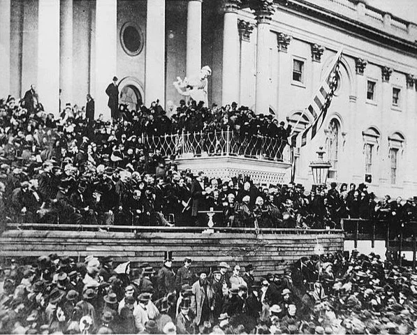
President Abraham Lincoln delivering his second inaugural address from the east portico of the U.S. Capitol on March 4, 1865. The Civil War was nearing its end, and the large crowd gathered reflects the weight of the moment for a divided nation. People filled the steps and grounds to witness the start of Lincoln’s final term. Capturing a turning point in American history, as the country stood on the edge of peace and reconstruction.
Military Map of the Middle and Southern States
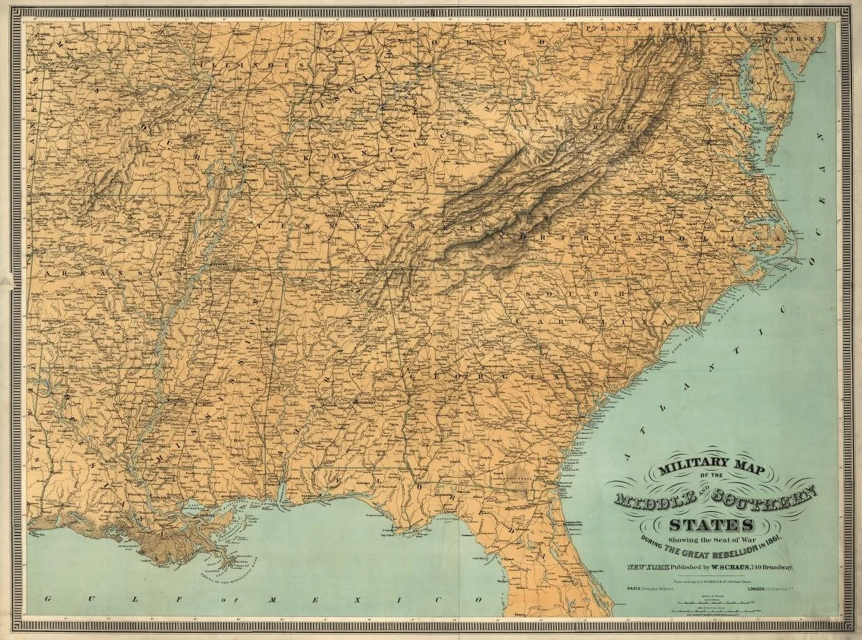
This 1861 military map shows the Middle and Southern States during the Civil War, highlighting the strategic locations and geography crucial to the conflict. Created by J.H. Colton and published by W. Schaus, the map provides detailed insights into the regions involved in the war, including transportation routes and significant cities.